


Contents |
Coordinates & Location type
- Latitude: 27.91667
- Longitude:84.25
- Latitude (DMS):27° 55' 0 N
- Longitude (DMS):84° 15' 0 E
Village Development Committees (VDCs)

- Ambukhaireni
- Arunodaya
- Baidi
- Bandipur
- Barbhanjyang
- Basantapur
- Bhanu
- Bhanumati
- Bhimad
- Bhirkot
- Byas
- Chhang
- Chhimkeswori
- Chhipchhipe
- Chok Chisapani
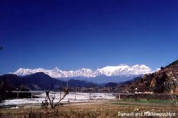
- Damauli
- Deurali
- Devghat
- Dharampani
- Dhorphirdi
- Dulegaunda
- Firfire
- Gajarkot
- Ghansikuwa
- Jamune Bhanjyang
- Kabilas
- Kahu Shivapur
- Keshavtar
- Khairenitar
- Kihun
- Kota
- Kotdarbar
- Kyamin
- Majhakot
- Manpang
- Pokhari Bhanjyang
- Purkot
- Raipur
- Ramjakot
- Ranipokhari
- Risti
- Rupakot
- Samungbhagawati
- Satiswara
- Sundhara
- Syamgha
- Tanahunsur
- Thaprek
- Mirlung
Map Of Tanahu
http://www.un.org.np/maps/district-maps/western/Tanahu.pdfSee also
References
- Districts of Nepal at statoids.com


| This Nepali location article is a stub. You can help Wikipedia by expanding it. |
No comments:
Post a Comment